The marine weather forecast comes from satellite imaging. It is only a prediction, and is only updated every 6 hours. In the satellite forecast, wind direction has an average error of +/- 35 degrees offshore, and even worse in coastal areas where the wind flows around landforms.
Most wind animations falsely give the illusion that as you zoom in, the satellite forecast has more and more detail. But weather satellites are 500 to 22,000 miles up in space. The resolution from satellite imaging is low, only telling you one wind direction for each cell, typically 15 x 15 nautical miles. But everyone knows that the wind is not the same everywhere within a cell that huge.


The SailTimer crowdsourcing platform collects wind data from recreational boats, ships, and public sources like weather buoys.
Our wind maps can receive data from both wired and wireless wind sensors.
The Air LinkTM can connect wind data on your NMEA wiring to smartphone apps and the cloud.
SailTimer also has both the wireless Wind Instrument, and the new wired Ultrasonic wind sensor for power boats or anyone needing a compact size.
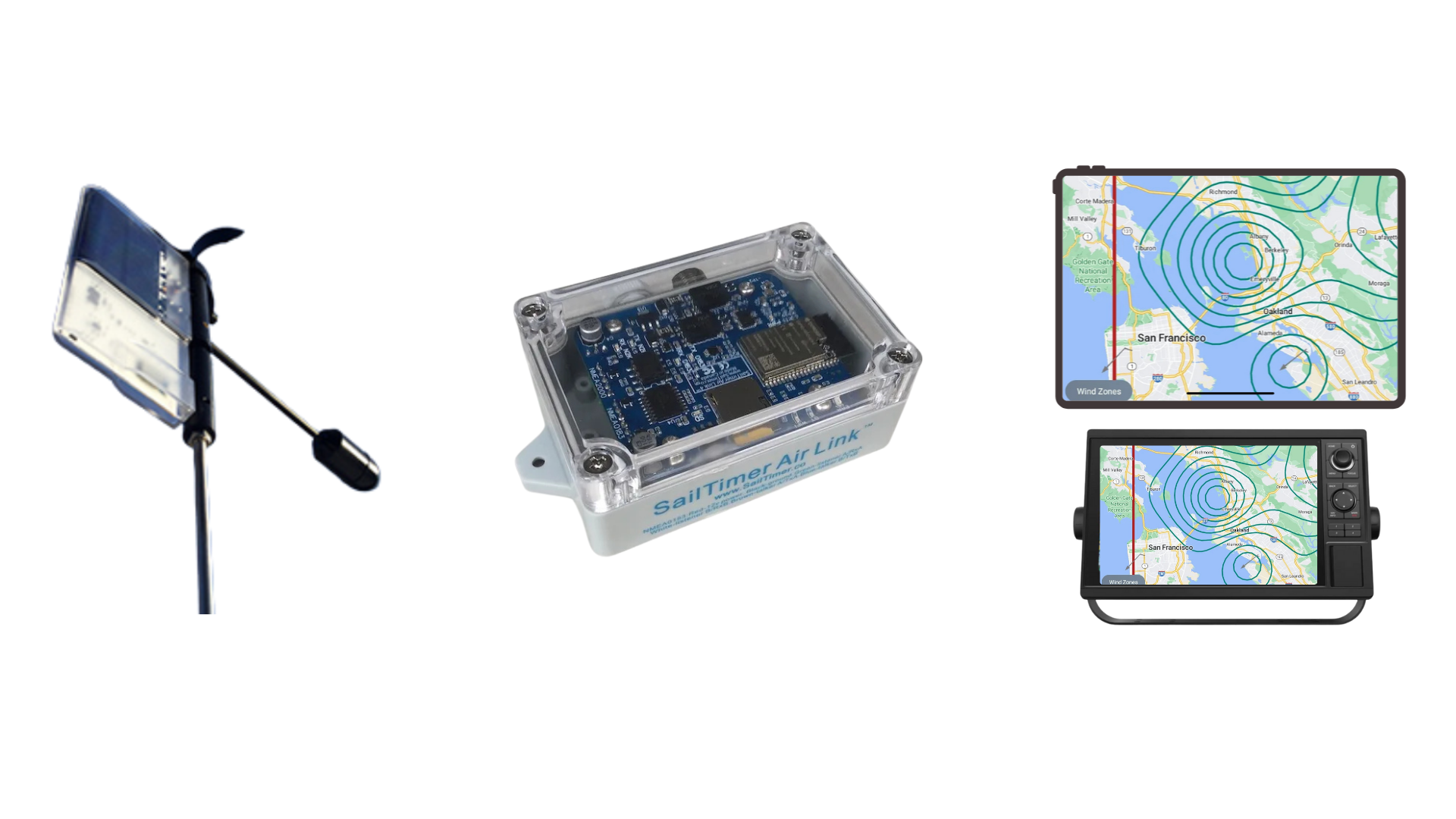
Send NMEA data to your chartplotter, smartphone, or tablet with the Air Link.
The more crowdsourced data we get, the better our maps of wind flow get. This is why we do not need to have real-time data available in every location.
Even in a region with few users, they can collect data along an entire coastline during one season. That shows how a wind from e.g. West flows down a channel or around a point.
Then if you want to know what the wind and sea state will be next Tuesday afternoon before heading out, if the satellite forecast is from the West at that time, you see precise contour lines for wind flow at that time.
You can get crowdsourced weather animations in the SailTimer app on Android and iOS, and soon in other boating apps we are partnering with.


See the press release on Weathernews Inc. (WNI) partnering with SailTimer to bring their forecast models from ships to recreational boaters in the SailTimer app. June 24, 2025.


SailTimer currently has over 110-million crowdsourced measurements from boaters worldwide to model wind flow in coastal areas. We archive all incoming data and index it with the GRIB forecast for that location and time. Then if the forecast for tomorrow afternoon at 2 pm says "20 knots from the South", we know exactly how the wind will be flowing behind an island or funneling into a channel. This modeling means that we do not need live data in every possible location, to provide more accurate wind forecasts than GRIB predicted wind.
This YouTube example shows the first-ever wind animation where the lines are spaced to show the actual resolution of the two data types. The GRIB data has white lines that are far apart. Crowdsourced wind zones use pink lines that become more plentiful the more you zoom in.